Property Record
462 Bushkill Center Rd, Nazareth, PA 18064
NEARBY LISTINGS FOR SALE OR LEASE
-
-
View all Nazareth listings for sale on LoopNet.com
Property Detail
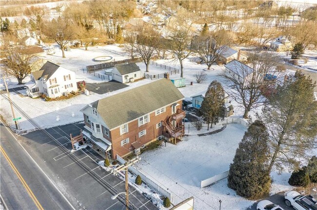
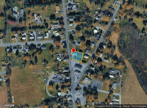
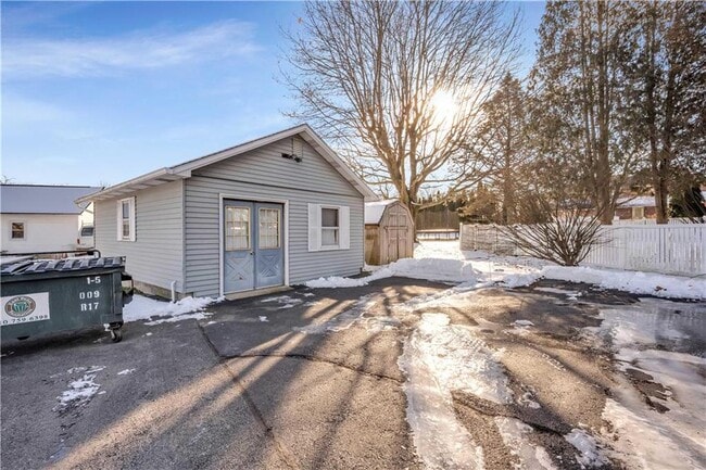
462 Bushkill Center Rd
Storesoffices
Northampton
X
Pennsylvania
42095C0145E
0.35 AC
2025
Lehigh Valley
2025
Philadelphia
015801
Allentown-Bethlehem-Easton, PA-NJ
3,049 SF
J7NE2-2-12-0406
DEMOGRAPHICS near 462 Bushkill Center Rd
1 Mile
3 Mile
5 Mile
2024 Total Population
4,657
22,051
57,074
2029 Population
4,683
22,208
57,577
Pop Growth 2024-2029
+ 0.56%
+ 0.71%
+ 0.88%
Average Age
43
44
44
2024 Total Households
1,736
8,308
21,127
HH Growth 2024-2029
+ 0.63%
+ 0.58%
+ 0.82%
Median Household Inc
$101,484
$86,517
$96,768
Avg Household Size
2.60
2.50
2.60
2024 Avg HH Vehicles
2.00
2.00
2.00
Median Home Value
$326,768
$305,736
$304,545
Median Year Built
1984
1969
1985
Nearby Places
Map Layers
Map Styles
 Street
 Aerial
- Restaurants
- Banks
- Shops
- Fitness
- Groceries
PUBLIC TRANSPORTATION
AIRPORT
Lehigh Valley International
DRIVE
WALK
Distance
Lehigh Valley International
22 min
13.0 mi
SALE & LEASE HISTORY
LISTING DATE
SALE/LEASE

Jul 06, 2022
For Sale
Jan 13, 2022
For Sale
Nearby Properties
Address
Land Use
TOTAL SIZE
Lot Size
Zoning
Address
Land Use
TOTAL SIZE
Lot Size
Zoning
1,001,315 SF
68.62 AC
I
Address
Land Use
TOTAL SIZE
Lot Size
Zoning
1,080,846 SF
74.80 AC
I
Address
Land Use
TOTAL SIZE
Lot Size
Zoning
1,107,596 SF
62.46 AC
RA
Address
Land Use
TOTAL SIZE
Lot Size
Zoning
1,020,930 SF
73.10 AC
RA
Address
Land Use
TOTAL SIZE
Lot Size
Zoning
654,480 SF
43.28 AC
RA
Address
Land Use
TOTAL SIZE
Lot Size
Zoning
76.92 AC
RA
Address
Land Use
TOTAL SIZE
Lot Size
Zoning
472,529 SF
43.86 AC
A
Address
Land Use
TOTAL SIZE
Lot Size
Zoning
130,145 SF
21.19 AC
R3
Address
Land Use
TOTAL SIZE
Lot Size
Zoning
503,770 SF
36.05 AC
LI
Address
Land Use
TOTAL SIZE
Lot Size
Zoning
49.45 AC
RA
Address
Land Use
TOTAL SIZE
Lot Size
Zoning
407,685 SF
35.05 AC
RA
Address
Land Use
TOTAL SIZE
Lot Size
Zoning
247,226 SF
33.68 AC
DP/IP
Address
Land Use
TOTAL SIZE
Lot Size
Zoning
159,194 SF
42.07 AC
I1
Address
Land Use
TOTAL SIZE
Lot Size
Zoning
8,390 SF
126.60 AC
I
Address
Land Use
TOTAL SIZE
Lot Size
Zoning
242,206 SF
23.01 AC
LI
Address
Land Use
TOTAL SIZE
Lot Size
Zoning
342,820 SF
26.20 AC
RA
Address
Land Use
TOTAL SIZE
Lot Size
Zoning
359,742 SF
12.64 AC
LI
Address
Land Use
TOTAL SIZE
Lot Size
Zoning
261,176 SF
22.56 AC
LI
Address
Land Use
TOTAL SIZE
Lot Size
Zoning
189,046 SF
13.15 AC
PO/IP
Address
Land Use
TOTAL SIZE
Lot Size
Zoning
200,803 SF
13.71 AC
PO/IP
Address
Land Use
TOTAL SIZE
Lot Size
Zoning
193,460 SF
18.26 AC
IBP
Address
Land Use
TOTAL SIZE
Lot Size
Zoning
159,552 SF
17.37 AC
A
Address
Land Use
TOTAL SIZE
Lot Size
Zoning
77,799 SF
13.40 AC
11
Address
Land Use
TOTAL SIZE
Lot Size
Zoning
81,758 SF
4.47 AC
PIC
Address
Land Use
TOTAL SIZE
Lot Size
Zoning
143,648 SF
8.90 AC
LI
Address
Land Use
TOTAL SIZE
Lot Size
Zoning
116,536 SF
7.31 AC
C
Address
Land Use
TOTAL SIZE
Lot Size
Zoning
178,074 SF
15.82 AC
EX1
Address
Land Use
TOTAL SIZE
Lot Size
Zoning
54,141 SF
2.77 AC
C
Address
Land Use
TOTAL SIZE
Lot Size
Zoning
11,355 SF
55.12 AC
I1
Address
Land Use
TOTAL SIZE
Lot Size
Zoning
6,336 SF
68.77 AC
EI
The World's #1 Commercial Real Estate Marketplace
Connect with us
© 2025 CoStar Group
The information above has been obtained from sources believed reliable. While we do not doubt its accuracy we have not verified it and make no guarantee, warranty or representation about it. It is your responsibility to independently confirm its accuracy and completeness. Any projections, opinions, assumptions, or estimates used are for example only and do not represent the current or future performance of the property. The value of this transaction to you depends on tax and other factors which should be evaluated by your tax, financial, and legal advisors. You and your advisors should conduct a careful, independent investigation of the property to determine to your satisfaction the suitability of the property for your needs.